Trip Planning
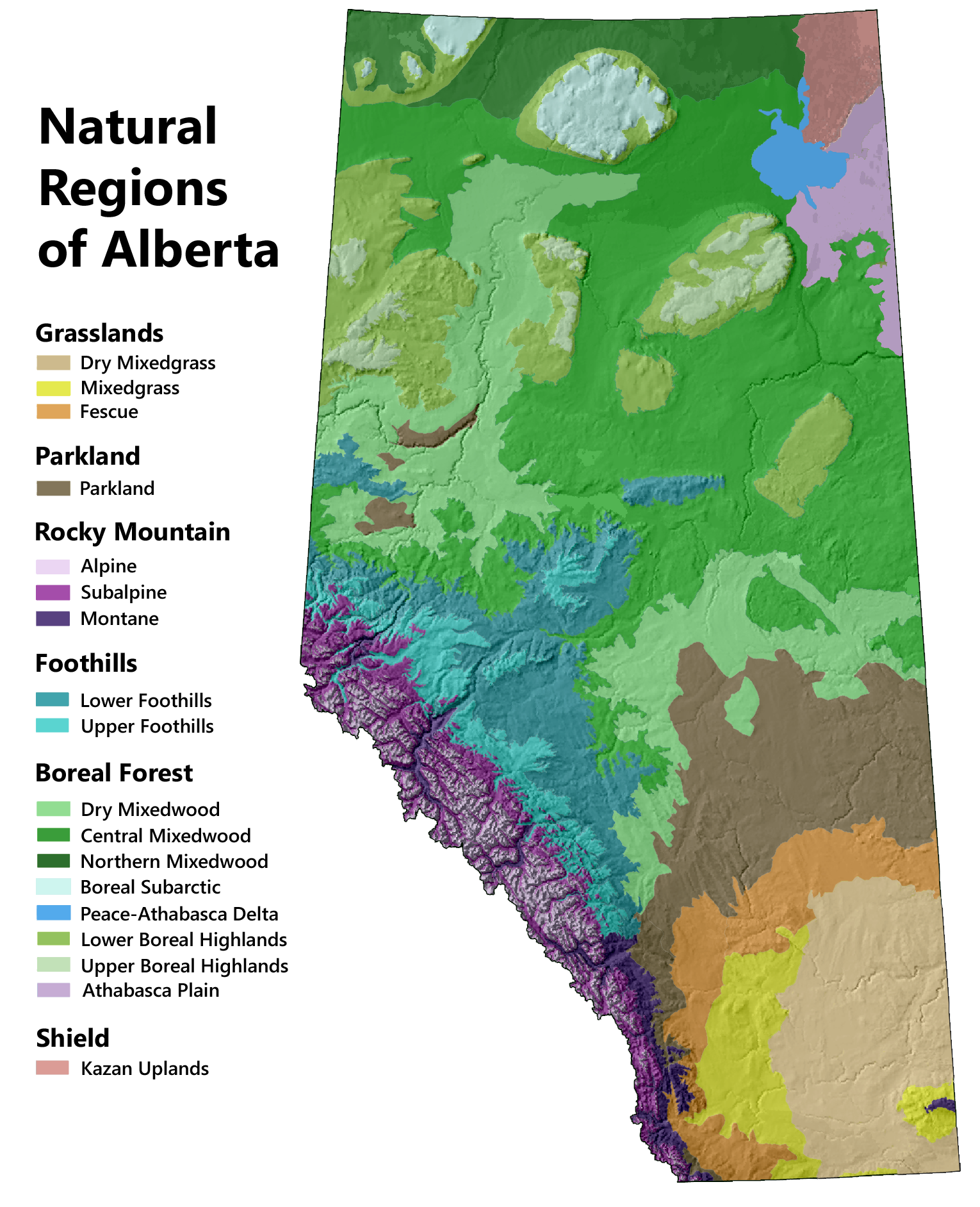
For many people, experiencing nature means a trip to the mountain parks, and for good reason. Alberta's Rocky Mountains feature some of the most spectacular scenery and accessible wildlife in all of Canada. But there is more to Alberta than the mountains. There are six distinct ecosystem types in the province, referred to as Natural Regions, and each has its own mixture of flora and fauna. All are worth exploring.
Finding Places to Go
Alberta is vast, so choosing a location to visit can be challenging. If your interest is in exploring Alberta's natural history, the best place to begin is our Ecosystems Page. There you will find information on the distribution of Alberta's plants and animals and the underlying physical features that drive these distributions.
Once you have a general idea of where you want to go, check to see if there are any provincial or national parks in the area. Parks are a good choice because the landscape will be reasonably intact and the site will be accessible by road. Most parks will also have a trail system to facilitate your explorations along with camping facilities. Our Parks Page provides an interactive, zoomable Google map that provides information on all of Alberta's parks as well as information on the different types of parks in the system.
You should also consider exploring landscapes outside of provincial parks, particularly those classified as Natural Areas. This is virtually a necessity in the Grasslands, Parkland, and Foothills regions because only 1% of these regions is represented within provincial or national parks. Natural Areas are relatively intact parcels of land that have been set aside by the government and various conservation groups for biodiversity conservation. Most are accessible to the public, though they offer few, if any, public facilities. Our Natural Areas Page provides an overview of these sites and how they can be accessed.
Lastly, it is possible to explore crown lands zoned for multiple use, which cover over half of the province. The challenge is in finding landscapes that have not been heavily disturbed by industry and that are accessible by road or canoe. In addition, there are regulations governing public access that vary by region. Our Public Lands Page provides an overview of Alberta's public lands and how they can be accessed.
Selecting a Trail
Except for open grasslands, exploring nature usually entails walking along an established trail. In Alberta, there are hundreds of trails to choose from; however, they are not all created equal. It's worthwhile seeking advice when planning a trip to make the most of your outing.
Because the mountain parks are very popular, several guidebooks are available to help you find the best trails in this region. One of the most useful is Don't Waste Your Time in the Canadian Rockies, which not only describes the main trails within the national parks but ranks them in terms of quality. Other guide books are available for specific regions, such as the Kananaskis Country Trail Guide.
Much less written information is available about trails outside of the mountain parks. Alberta Parks provides trail reports for 20 parks, and many parks provide short summaries of their trail system on their websites. Another resource is the book 200 Nature Hot Spots in Alberta, which provides short descriptions of interesting sites around the province. This book is useful for generating ideas about places to visit, but it does not provide information on trails.
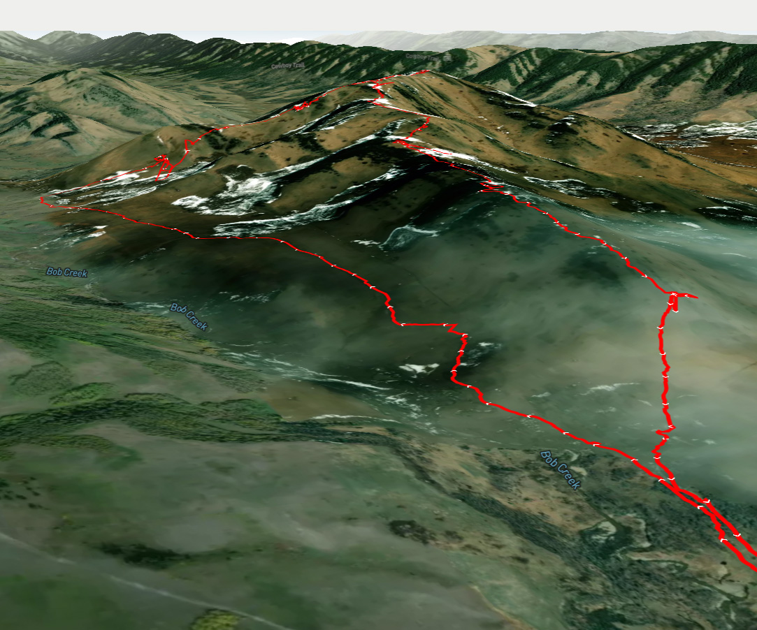
In recent years, online platforms, such as AllTrails and Gaia GPS, have emerged as important trip planning tools. These platforms provide satellite and contour maps, much like Google Maps, that show established hiking trails as well as routes shared by other hikers. Once you find a trail in an area you are interested in, you can view a short written description, including length and elevation gain, along with user-submitted photos and trail reports. All this comes at no charge. With a paid subscription, you can save maps for offline use in an associated phone app. The app uses your phone's GPS to record your route as you travel, so you always know where you are relative to the trail and where you have been, even without cell service. Of course, caution is warranted, because the digital route may not track the actual trail precisely and trail conditions may be different than what other users experienced.
Platforms like AllTrails show hiking routes overlaid on satellite and contour maps. As with Google Maps, you can zoom in to get a good sense of what the landscape is like (e.g., whether it is intact or heavily disturbed). With a paid subscription you also have access to 3D maps, as shown above, providing unparalleled previews of potential hikes.
Canoe and Kayak Trips
An alternative approach to exploring Alberta's natural history is to travel by canoe or kayak. Alberta has seven major river systems, and downstream from the Rocky Mountains, most stretches of river are fairly easy paddling, allowing you to focus on nature viewing. A major benefit of travelling by water is that it provides access to wilderness areas that are inaccessible by road.
Mark’s Guide for Alberta Paddlers (2014) by Mark Lund is an excellent resource for planning canoe trips. However, it is now out of print and may be difficult to find. Fortunately, there are also good planning resources online. The Paddling Maps Website provides a fairly comprehensive listing of Alberta paddling trips with written descriptions. The Paddle Alberta Website is another source of information on canoe trips. The Hike Bike Travel Website offers specific recommendations on the best paddle trips in the province.
The View From the Water
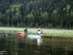
Surprisingly for a land-locked province, much of Alberta is only easily accessible by water. Paddling offers views of wildlife, native plants, and spectacular scenery that even backcountry hikers or cyclists don’t get to see.
Read tips for nature-based paddling by well-known educator, Mark Lund.
Read More


